Ordnance Survey Publish Mars Map
UK Mapping agency Ordnance Survey have released the first available paper map of the planet Mars.
OS already have the reputation of producing the most detailed maps in the world, and can now take that title to our nearest planetary neighbour.
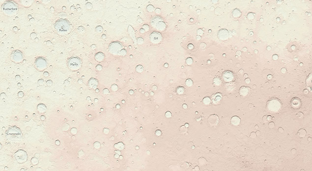
The map - created in a 1:4,000,000 scale - may not be quite as detailed as your standard Explorer or Landranger series, but when almost all of the features are craters, you can forgive them.
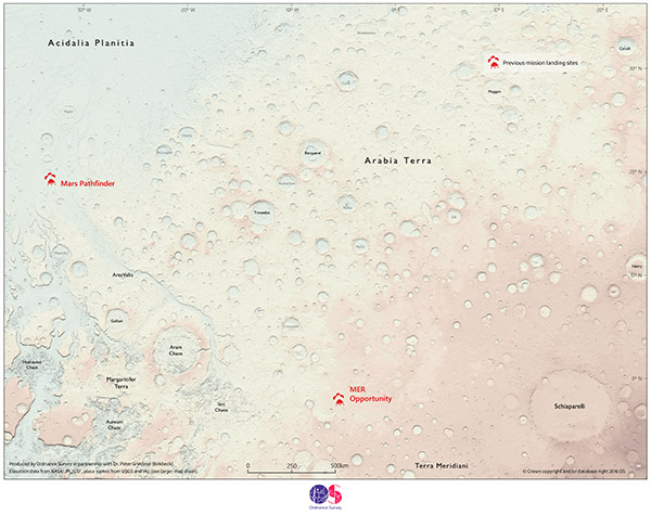
The map focuses on an area known as Arabia Terra - one of the oldest surfaces of Mars, and one of the most heavily cratered. There are some pretty fascinating topographical features including 'Hydraotes Chaos' and 'Schiaparelli' - a crater the size of Wales named after the astronomer who first noticed the region in the 19th century. The area is also the landing sites of the Mars Pathfinder and MER Opportunity Rovers.
You can check out a full resolution of the fascinating image here and you can learn more about how Ordnance Survey created the map here.
![]()
|
|
About the Author:Mike Humphreys - Online ContentMike is a keen cyclist, snowboarder, hill walker and Land Rover tinkerer. He has travelled extensively, spending a year living out of a van in New Zealand before joining Ellis Brigham four years ago. Can usually be found walking his dogs or tortoises. |

